It is not a matter of IF but WHEN the next category 3 "1938 Long Island Express" or "category 3 (1954 Carol)" will once again impact Southern New England under very similar meteorological circumstances! The biggest issue now is the tremendous build up of our coastal population and combined with a new generation of people that have never experienced a Category 3 hurricane. This combination is sure to be destructive and deadly to our region.
The average time period for a Category 3 hurricane in New England is 30 to 50 years. Dating back to records beginning in 1851, there have been 15 recorded hurricane landfalls in New England, with an average of one landfall every 11-12 years. The most recent major hurricane to make landfall in the region was Hurricane Carol in 1954.
So, it has been 87 years since the 1938 Long Island Express and 71 years since 1954 Carol. Do the math folks. We are way overdue for not only a hurricane but a MAJOR CATEGORY 3.
This future Cat 3 event will be catastrophic for Southern New England. We continue to NOT learn from the past. The Atlantic hurricane season begins on June 1st yearly and ends on November 30th. Every person living along the Atlantic and Gulf coast need to be prepared by June 1st. For Southern New Englander's, we need to be vigilant in August and September when our waters are at their peak temperatures. Go online and check out all the hurricanes that have made landfall in SNE and you will notice that all made impact in August or September. There is a meteorological reason for this.
Take a long look at the images in this gallery and you will see the destructive and deadly power of a category 3 hurricane in our area. Some of our recent past hurricanes like Belle, Gloria and Bob pale in comparison since they were much weaker at category 1 and 2.
DO THE FOLLOWING BY JUNE 1ST:
HAVE AN EMERGENCY DIASTER KIT AND PLAN IN PLACE FOR YOUR FAMILY INCLUDING WHERE THE NEAREST OFFICIAL SHELTER IS.
HAVE A WHOLE-HOUSE GENERATOR READY AND WORKING.
HAVE HOMEOWNERS AND FLOOD INSURANCE. (HOMEOWNERS INSURANCE DOES NOT COVER FLOOD).
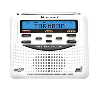
HAVE A NOAA S.A.M.E. WEATHER RADIO WITH SPARE BATTERIES.
BE AWARE IF YOU RESIDE NEAR ANY RIVERS OR STREAMS.
REMEMBER THAT THE STORM SURGE IS A HURRICANE'S DEADLIST KILLER.
ALSO BE AWARE OF TORNADOES THAT CAN SPAWN FROM THE HURRICANE'S (OR TROPICAL STORM'S) OUTER BANDS.
HURRICANES IN SOUTHERN NEW ENGLAND ARE KNOWN TO BE FAST MOVERS ONCE THEY REACH THE VICINITY OF THE CAROLINA OUTER BANKS SO THERE MIGHT NOT BE MUCH TIME TO PREPARE.
LISTEN ONLY TO NOAA NATIONAL WEATHER SERVICE AND THE NATIONAL HURRICANE CENTER AS WELL AS LOCAL METEOROLOGISTS FOR THE LATEST UPDATES ON THE STORM.
MY FEELING IS THAT OUR (SNE) NEXT CAT 3 HURRICANE WILL HAPPEN WITHIN THE NEXT 13 YEARS BUT I WOULD NOT BE SUPRISED IF IT HAPPENED WITHIN THE NEXT 5 YEARS.
The 1938 hurricane was a "Cape Verde" type coming off the coast of Africa. Our 1954 Carol originated in the Bahamas and so was also a fast mover but had a shorter distance to travel to get to SNE.
The National Weather Service and local meteorologist will tell you: "A TROPICAL STORM IN THE BAHAMAS IS SOUTHERN NEW ENGLAND'S BUSINESS!"
BTW: TWO OTHER HISTORIC CATEGORY 3 HURRICANES THAT HAVE MADE LANDFALL IN SNE IS THE "GREAT COLONIAL HURRICANE OF 1635" AND THE "GREAT GALE OF 1815". JUST SAYING!